A general map of the middle British colonies in America
Dublin Core
Title
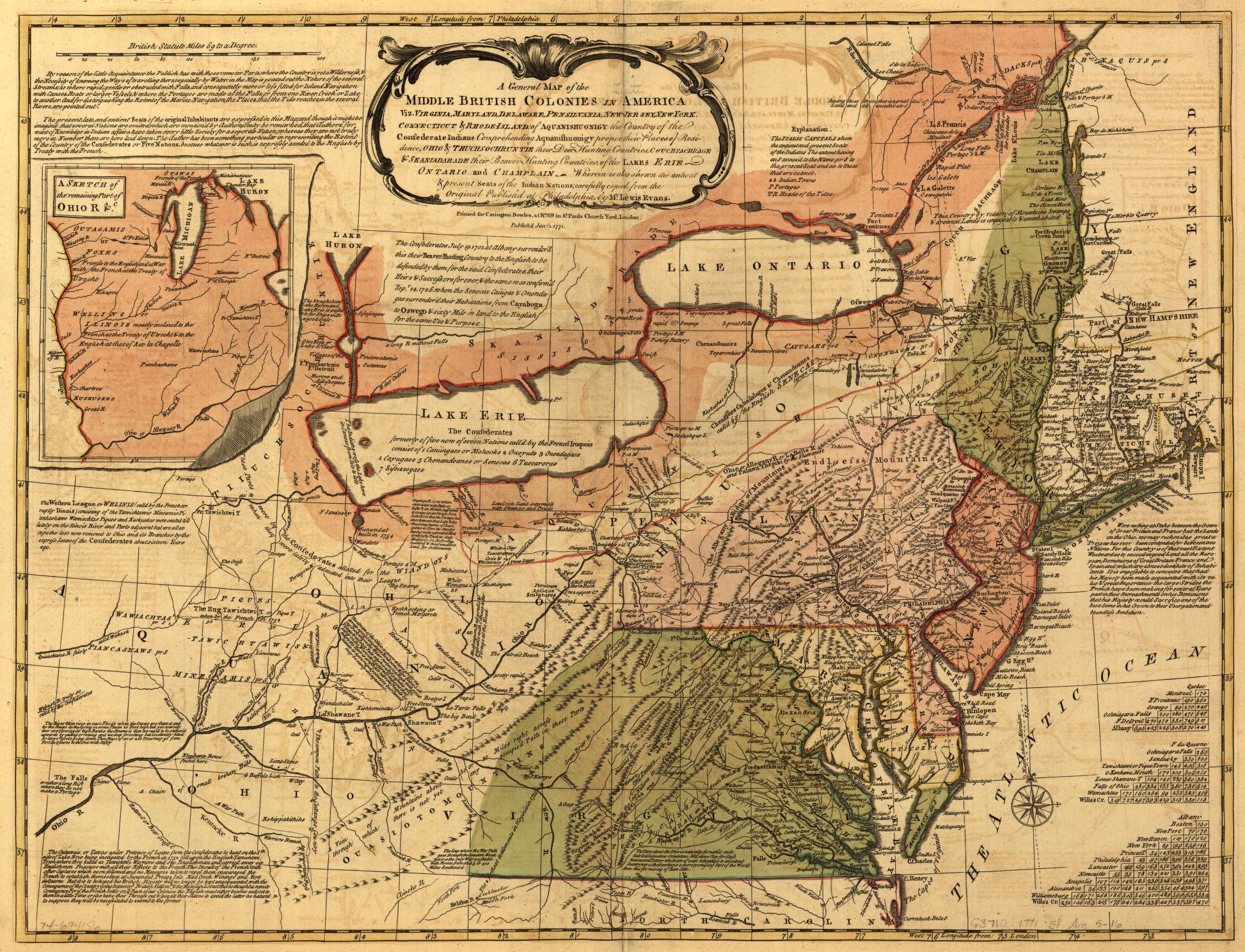
A general map of the middle British colonies in America
Description
A general map of the middle British colonies in America, viz. Virginia, Maryland, Delaware, Pensilvania, New-Jersey, New York, Connecticut & Rhode-Island: Of Aquanishuonigy the country of the confederate Indians comprehending Aquanishuonigy proper, their places of residence, Ohio & Thuchsochruntie their deer hunting countries, Couchsachrage & Skaniadarade their beaver hunting countries, of the Lakes Erie, Ontario and Champlain. Wherein is also shewn the antient & present seats of the Indian nations.
Creator
London, Printed for Carington Bowles, 1771.
Date
1771
Rights
The maps in the Map Collections materials were either published prior to 1922, produced by the United States government, or both (see catalogue records that accompany each map for information regarding date of publication and source). The Library of Congress is providing access to these materials for educational and research purposes and is not aware of any U.S. copyright protection (see Title 17 of the United States Code) or any other restrictions in the Map Collection materials.
Relation
https://lccn.loc.gov/74694156
Format
Map
Language
English
Files
Collection
Citation
London, Printed for Carington Bowles, 1771., “A general map of the middle British colonies in America,” Benedict Arnold: Dismantling a Hero to Build a Nation, accessed October 2, 2026, https://angelacruz.org/BenedictArnold/items/show/37.